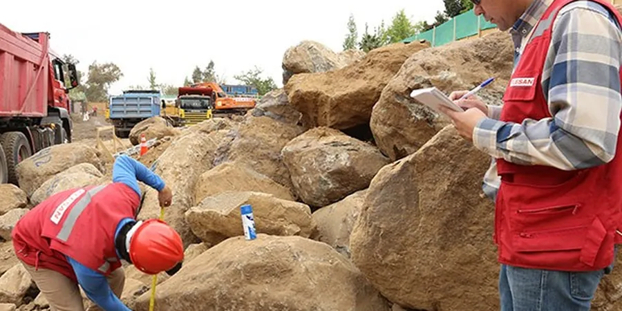
Winston-Salem sits right on the Triassic Basin, and that means a lot of what we call saprolite — weathered bedrock that still holds the original rock structure but crumbles fast under load. The upper 15 to 30 feet across Forsyth County is typically silty sand with mica flakes, grading into partially weathered felsic gneiss. A standard soil mechanics study here has to go beyond a boring log: we need to nail down the collapse potential of that saprolite and whether the fines will pump water during wet winters. When a contractor breaks ground off Hanes Mill Road or near the old RJR industrial tracts, the lab work — triaxial, consolidation, direct shear — becomes the only honest conversation between the design and what the ground will actually do. We back every report with ASTM D2487 classification and index testing run in our accredited lab, so the numbers you get aren't generic, they're Winston-Salem numbers.
Piedmont saprolite looks like rock but behaves like soil under load — that's the gap a proper soil mechanics study closes.
Scope of work
Area-specific notes
Winston-Salem grew fast in the postwar decades, and a lot of the commercial corridors — think Peters Creek Parkway and the Hanes Mall area — were built over cut-and-fill operations that nobody documented the way we'd document them today. Old fill, sometimes 10 feet thick, mixed with construction debris from the textile and tobacco era, sits right under slab-on-grade buildings and parking lots. A soil mechanics study that skips the consolidation behavior of that fill is asking for differential settlement trouble five years down the road. The other quiet risk is seasonal groundwater perched on the partially weathered rock surface: it rises fast after a heavy rain and saturates the base of footings that looked perfectly dry during the August site visit. We've seen it repeatedly on sites along the Silas Creek watershed — the numbers from a summer boring don't tell the full story unless you interpret them with local hydrogeology in mind.
Standards used
ASTM D2487 – Soil Classification (USCS), ASTM D4767 – Consolidated-Undrained Triaxial Test, ASTM D2435 – One-Dimensional Consolidation, ASTM D5084 – Hydraulic Conductivity (Flexible Wall), IBC Chapter 18 – Soils and Foundations
Linked services
Foundation Design Parameters
Triaxial shear strength, consolidation settlement curves, and bearing capacity analysis for shallow footings, mat foundations, and deep piles — calibrated to the saprolite and weathered rock profile under your site.
Compaction and Fill Evaluation
Proctor curves, field density correlation, and moisture conditioning guidance for structural fill placed on Piedmont residual soils, including re-use of on-site borrow material.
Slope and Excavation Stability
Effective stress shear parameters and pore pressure modeling for cut slopes, retaining walls, and temporary excavation support — critical on sites with steep grades along the Yadkin River bluffs.
Pavement Subgrade Characterization
CBR, resilient modulus correlation, and frost-susceptibility screening for parking lot and roadway subgrades, with attention to the silty mica-rich fines that dominate local soils.
Typical parameters
Quick answers
How much does a soil mechanics study cost for a typical commercial lot in Winston-Salem?
For a standard commercial lot — think one to two acres with a single-story building and parking — the soil mechanics study typically runs between US$3,250 and US$5,710. The spread depends on how many borings the site needs, whether we're pulling undisturbed Shelby tubes for consolidation and triaxial, and if the project requires deeper exploration for bedrock bearing. A site with thick undocumented fill or steep grades will push toward the upper end because we'll run more lab cycles to characterize the variability.
What makes Piedmont residual soils different from regular soil?
The main difference is that Piedmont residual soils, and especially the saprolite we see across Winston-Salem, retain the texture and structural ghosts of the parent rock — typically felsic gneiss or schist — but the feldspars have weathered to clay and the mica is free and flaky. That gives you a material that looks competent in a split spoon but can collapse structurally when it gets saturated and loaded. The fines content sits in that tricky range where it drains poorly but isn't a true fat clay either, so you can't just apply textbook sand or clay assumptions.
How many borings do I need for a building permit in Forsyth County?
Forsyth County doesn't publish a fixed number — it's performance-based under IBC Chapter 18. In practice, for a single commercial building under 10,000 square feet, we typically recommend three to four borings, spaced to catch any fill pockets or weathering profile changes. If the site has known cut-and-fill history or is adjacent to a creek, we'll add at least one boring on the downgradient side to check for perched water. The geotechnical report has to justify the exploration density based on the variability we document.
How long does the lab testing part of the study take?
Once the samples arrive at the lab, classification tests — grain size, Atterberg limits, natural moisture — typically turn around in three to five business days. Consolidation and triaxial tests run longer, usually ten to fourteen business days, because we have to saturate the specimens, set up the load increments, and let primary consolidation complete at each step. If the project schedule is tight, we can issue a preliminary report with classification and index data while the strength and consolidation tests are still running.